WGS 10 (USA 291)
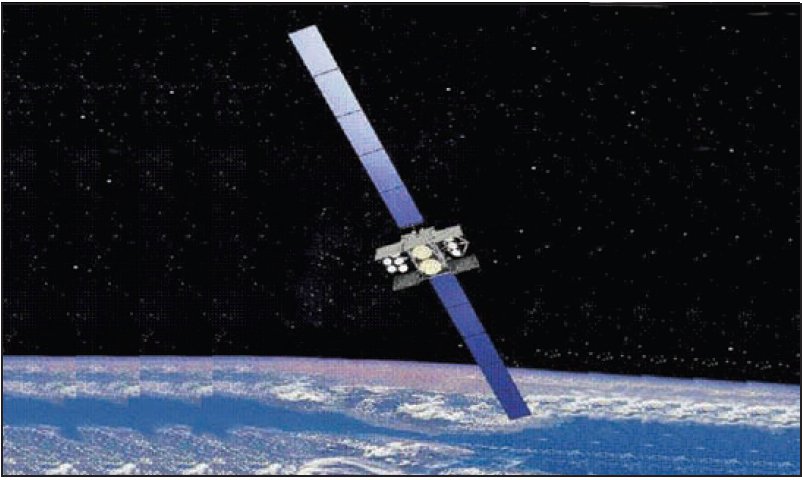
About WGS 10 (USA 291)
WGS 10, also catalogued under the designator USA-291 and carrying the COSPAR identifier 2019-014A, is a United States military communications satellite launched on March 15, 2019. Assigned NORAD catalog number 44071, it forms part of the Wideband Global SATCOM (WGS) constellation operated by the United States Air Force — a program designed to provide high-capacity, wideband communications connectivity for military users across the globe. As the tenth satellite delivered to orbit under this program, WGS 10 represents a significant milestone in the long-running effort to expand and modernize the United States military's space-based communications architecture.
Mission and Purpose
The Wideband Global SATCOM program exists to supply the United States Department of Defense and allied partners with robust, high-throughput communications links spanning a wide range of frequency bands. Military operations from command-and-control networks to battlefield data relay depend heavily on reliable satellite connectivity, and the WGS constellation was developed to meet this demand at a scale that older defense communications satellites could not satisfy. Each satellite in the series is intended to significantly increase the amount of information that can be transmitted compared to predecessor systems, supporting everything from intelligence and surveillance relays to logistics communications and joint coalition operations with partner nations.
WGS 10 is the tenth member of this satellite family to achieve orbit, completing a sequence that began more than a decade before its own launch. The program expanded methodically over the years, with each new satellite extending the system's overall coverage and redundancy. WGS satellites are not narrowly assigned to a single geographic theater; they are positioned in geostationary orbit at various longitudes to provide overlapping coverage across multiple regions of strategic interest, including the Pacific, Atlantic, and other theaters where U.S. and allied forces are active.
Although the specific mission parameters, orbital slot assignment, and current operational status of WGS 10 are not publicly disclosed in available catalogs — a common posture for military communications assets — its role within the broader WGS architecture is consistent with the constellation's documented purpose: delivering reliable wideband communications to joint warfighters, coalition partners, and other authorized users. The United States Air Force procured the satellite, continuing the service's long-standing responsibility for military space communications prior to the establishment of the United States Space Force.
Orbit and Tracking
WGS 10 occupies a geostationary orbit, the highly circular belt of space approximately 35,786 kilometers above Earth's equator where a satellite's orbital period matches the planet's rotation rate. For WGS 10 specifically, tracking data confirms an apogee of 35,800 kilometers and a perigee of 35,797 kilometers — figures that together indicate an exceptionally circular orbit with negligible eccentricity. The difference between these two values is so small as to be operationally insignificant, confirming a nearly perfect circular geostationary profile.
The satellite's orbital inclination is recorded at 0.0 degrees, meaning it travels directly over the equatorial plane without the seasonal drift in apparent position that characterizes slightly inclined geosynchronous orbits. This zero-inclination characteristic is essential for communications satellites intended to appear stationary relative to fixed ground antennas, allowing terminals on the surface to maintain a constant pointing angle without active tracking adjustments.
The orbital period of WGS 10 is 1,436.3 minutes — approximately 23 hours and 56 minutes — which corresponds closely to one sidereal day, the period of Earth's rotation relative to distant stars rather than the Sun. This synchronization is the defining property of geostationary orbit, and WGS 10's period confirms it is properly placed in this operational band.
From a tracking perspective, objects in geostationary orbit present a distinctive profile in satellite catalogs. Because they remain nearly stationary relative to Earth's surface, they do not pass overhead in the conventional sense experienced by satellites in low or medium orbits. WGS 10 has remained continuously in orbit since its launch date and has not undergone decay or reentry, as confirmed by current tracking records. Its NORAD catalog entry (44071) and international designator (2019-014A) allow it to be unambiguously identified among the many objects populating the geostationary belt.
Design and Operator
WGS 10 is operated by the United States Government, specifically through the United States Air Force, which manages the Wideband Global SATCOM constellation as a whole. The Air Force has historically held responsibility for procuring, launching, and operating military communications satellites, and the WGS program represents one of its flagship space-based communications efforts. Following the establishment of the United States Space Force in late 2019, operational responsibilities for programs of this nature have transitioned or are in transition to the new service branch, though the Air Force remains associated with procurement and legacy operations.
The manufacturer of WGS 10 is not recorded in publicly available tracking catalogs. It is worth noting, however, that the WGS program as a whole has been associated with major American defense aerospace contractors, and each satellite in the series is built to common or evolved specifications intended to maintain compatibility across the constellation. Precise details about the satellite's mass, onboard payload configuration, power systems, and transmit frequencies remain outside what is publicly disclosed, which is standard practice for operational military communications satellites.
WGS satellites in general are designed to operate across multiple frequency bands, including X-band and Ka-band, which serve different classes of military users and terminal types. The program has also enabled interoperability with allied nations, with several partner countries having contributed to the program's funding in exchange for access to its communications capacity. Whether WGS 10 specifically is assigned to support coalition partners cannot be confirmed from public records, but the program-level framework for such arrangements is well established.
Program Context and Significance
The launch of WGS 10 in March 2019 marked the completion of what had been planned as the core constellation of ten satellites under the WGS program's original and extended acquisition strategy. Reaching a constellation of ten operational satellites represents a substantial communications capacity overhead compared to what the U.S. military had available in earlier generations of wideband satellite communications infrastructure.
The WGS program was conceived as a successor to the Defense Satellite Communications System (DSCS), which had served U.S. military communications needs for decades but was not designed for the data-intensive demands of modern networked warfare. The shift to WGS brought a dramatic increase in throughput, enabling the movement of large volumes of data — video, imagery, and broadband connectivity — in support of the information-driven operational concepts that define contemporary military doctrine.
WGS 10's placement in geostationary orbit ensures it will remain a functional part of the constellation for its full design service life. Satellites in properly maintained geostationary orbit do not naturally decay in any operationally meaningful timeframe, as the altitude is well above the residual atmospheric drag that causes orbital decay in lower regimes. As of the data available in current tracking records, WGS 10 remains in orbit and shows no indication of decommissioning. The full operational status of the satellite — whether it is active, on standby, or otherwise — is not publicly available in catalog data.
The launch itself took place on March 15, 2019, at 20:00 Eastern Daylight Time, and the object was promptly catalogued by U.S. Space Surveillance Network sensors, receiving its NORAD designation and international identifier in the standard manner applied to all tracked orbital objects. Its classification as a payload — as opposed to a rocket body or debris object — reflects its status as the primary functional object delivered by its launch vehicle.
Observability and Tracking Notes
Because WGS 10 resides in geostationary orbit at an altitude of approximately 35,800 kilometers, it is not observable by the naked eye under ordinary circumstances. Satellites at geostationary altitude are extremely distant compared to low-orbit objects and do not move across the sky relative to ground-based observers. When viewed through a telescope, geostationary satellites appear as faint, stationary points of light against the star field — or more precisely, they appear to remain fixed while stars trail during a time-exposure photograph due to Earth's rotation.
Amateur astronomers and satellite observers can locate WGS 10 using its NORAD catalog number (44071) in compatible tracking software, which will display its fixed equatorial position in the sky. For observers in the Northern Hemisphere, geostationary satellites appear low on the southern horizon; those closer to the equator will see them at higher elevations. The satellite's apparent brightness in the optical spectrum has not been publicly characterized, and as a military asset, no cooperative tracking or beacon information is available to the general public.
For the purposes of catalog-based tracking on this site, WGS 10's near-zero eccentricity and precisely equatorial inclination make its positional prediction straightforward, and its orbital elements are expected to remain highly stable over time absent active station-keeping adjustments.
Altitude history
Apogee and perigee for WGS 10 (USA 291) across 148 days of archived orbital elements (150 element sets, one per day).
Derived from our own archive of CelesTrak orbital elements, sampled every 3 hours. Short windows show drag and station-keeping; they are not a reentry prediction.
Related satellites
Sources & further reading
Embed this satellite on your site
Free for editorial use. Attribution back to LowEarth is required.
<iframe src="https://lowearth.app/embed/44071" width="640" height="400" frameborder="0" allow="fullscreen"></iframe>