WGS F9 (USA 275)
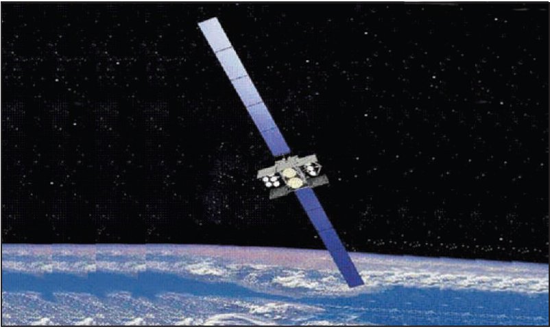
About WGS F9 (USA 275)
WGS F9, catalogued by NORAD under identifier 42075 and internationally designated 2017-016A, is a United States military communications satellite operating in geostationary orbit. Better known as Wideband Global SATCOM 9, or WGS-9, it represents the ninth entry in the United States Air Force's Wideband Global SATCOM constellation — a programme designed to provide high-capacity, broadband satellite communications in support of American military and allied operations worldwide. The satellite was launched on 18 March 2017 and remains operational in orbit as of the time of writing, positioned at approximately 135° West longitude above the equator.
Mission and Purpose
The Wideband Global SATCOM programme exists to meet the United States military's ever-expanding demand for reliable, high-throughput satellite communications. As modern military operations have grown increasingly reliant on data-intensive applications — from intelligence, surveillance, and reconnaissance feeds to command-and-control networks and unmanned aerial vehicle operations — the capacity provided by older communications satellites has repeatedly been outpaced by demand. The WGS constellation was conceived and developed as a direct response to that gap, offering substantially greater bandwidth and flexibility than its predecessors.
WGS-9 serves as one node in that broader network of geostationary communications satellites. Each WGS satellite is capable of supporting a wide range of transmission frequencies and can relay communications between ground terminals, aircraft, ships, and other military platforms across a significant portion of the Earth's surface. The constellation as a whole is intended to provide near-global coverage, with individual satellites positioned at strategic longitudes to ensure overlapping reach across key operational theatres.
The specific mission parameters and current operational status of WGS-9 are not publicly disclosed in official satellite catalogues, which is consistent with standard practice for military communications satellites. The satellite is operated by the United States Air Force, which procured it as part of the ongoing expansion of the WGS constellation. The programme has at various points involved allied partner nations contributing funding in exchange for access to the system's communications capacity, a cooperative arrangement that has broadened both the financial base and the international utility of the constellation.
Because WGS-9 occupies the 135° West orbital slot, it is well positioned to serve communications requirements across the Pacific region, including connections between the continental United States, Hawaii, Guam, Japan, and other areas of strategic significance to American and allied military forces in the Indo-Pacific theatre. This positioning reflects deliberate planning within the broader WGS architecture to ensure adequate coverage across what has become one of the most operationally active regions for United States forces.
Orbit and Tracking
WGS-9 occupies a geostationary orbit, a category of orbit that places a satellite at an altitude of approximately 35,786 kilometres above the Earth's equator — the precise height at which an object's orbital velocity matches the rotational speed of the Earth beneath it. The practical consequence of this configuration is that the satellite appears stationary relative to the ground, making it ideal for communications applications that depend on fixed, persistent links between specific points on the surface.
The orbital data on record for WGS-9 confirms this classification. Its apogee stands at 35,796 kilometres and its perigee at 35,794 kilometres, indicating an orbit so nearly circular that the difference between the two is effectively negligible — a separation of just two kilometres across a total altitude of roughly 35,800 kilometres. This near-perfect circularity is characteristic of an operationally mature geostationary spacecraft that has been precisely manoeuvred into its intended slot. The orbital inclination is recorded at 0.0°, meaning the satellite tracks almost exactly along the equatorial plane with virtually no north-south drift, and its orbital period is 1,436.2 minutes — extremely close to the 1,436-minute sidereal day that defines the geostationary condition.
For tracking purposes, WGS-9 is listed in the NORAD catalogue under identifier 42075, and its COSPAR international designator is 2017-016A. The "A" suffix in the COSPAR designation indicates it was the primary payload of its launch event, designated 2017-016, which corresponds to the sixteenth orbital launch attempt globally in calendar year 2017. These identifiers allow ground-based tracking networks to maintain a continuous record of the satellite's orbital elements and confirm its continued presence in orbit.
Because WGS-9 sits in geostationary orbit above a fixed equatorial longitude, its position relative to observers on the ground changes very little over time. Unlike satellites in low Earth orbit, which traverse the sky in a matter of minutes, a geostationary satellite effectively hangs at a constant point above the horizon. The elevation angle at which it appears above that horizon depends on the observer's latitude — from equatorial locations it appears nearly overhead, while from higher latitudes it sits progressively lower in the sky.
Design and Operator
WGS-9 is operated by the United States Air Force as part of the Wideband Global SATCOM programme, which falls under the broader umbrella of military space and communications infrastructure managed by the Air Force's space enterprise. The manufacturer of this particular satellite is not recorded in publicly available catalogue data, and the spacecraft's mass is similarly not disclosed in official sources. This absence of detail is not unusual for military payloads, where engineering specifications and physical parameters are routinely withheld from the public domain.
Each satellite in the WGS series is built to handle significant communication throughput across multiple frequency bands, providing the kind of flexible, reconfigurable connectivity that modern joint military operations demand. While precise technical specifications for WGS-9 specifically are not available in the public record, the WGS programme as a whole is understood to represent a substantial advance over earlier American military communications satellites in terms of raw capacity and operational flexibility. The satellites are designed to be reprogrammable in orbit, allowing ground operators to redirect bandwidth to where it is most urgently needed rather than being constrained by fixed, pre-launch configurations.
The satellite was procured by the United States Air Force and is classified as a payload in the NORAD catalogue, distinguishing it from associated rocket bodies or debris objects that may have accompanied the same launch. WGS-9's launch on 18 March 2017 placed it directly into, or very close to, its operational geostationary slot, consistent with the practice of launching communications satellites into geostationary transfer orbits before raising them to their final positions through a sequence of engine burns.
Significance and Current Status
WGS-9 holds a particular place in the history of the Wideband Global SATCOM programme as the ninth satellite to reach orbit in the series, marking a continued and steady expansion of American military satellite communications capacity. The progression of the WGS constellation from its earliest members to WGS-9 reflects both the sustained investment of the United States in space-based military infrastructure and the growing recognition, within defence planning, that assured communications are as essential to modern military effectiveness as any physical capability.
The satellite's placement at 135° West is strategically significant in the context of American military posture. The Indo-Pacific region has become a central focus of United States defence strategy in recent decades, and reliable, high-capacity satellite communications across that vast oceanic and territorial expanse are essential to sustaining the command, control, and coordination that joint operations in the region require. WGS-9's orbital position ensures it contributes directly to that need.
As of the current date, WGS-9 has not undergone any recorded decay or reentry event and remains in orbit, continuing to fulfil its operational role within the constellation. The highly stable and nearly perfectly circular nature of its geostationary orbit means it will remain in that position for the foreseeable future without significant natural perturbation, though active station-keeping manoeuvres are required periodically to maintain its precise longitude and to counteract the gravitational influences of the Moon, Sun, and the slight asymmetry of the Earth's own gravitational field.
The WGS programme, of which WGS-9 is one element, represents one of the principal mechanisms through which the United States and its military partners maintain continuous, high-bandwidth satellite communication links across the globe. Its continued operation is a quiet but foundational component of the communications architecture underpinning American and allied military activity, particularly across the vast distances of the Pacific. While the specifics of WGS-9's operational performance and current mission assignments are not available in open sources, its presence in the catalogue confirms that this asset continues to occupy its designated orbital slot, available for whatever communications role its operators require.
Altitude history
Apogee and perigee for WGS F9 (USA 275) across 148 days of archived orbital elements (150 element sets, one per day).
Derived from our own archive of CelesTrak orbital elements, sampled every 3 hours. Short windows show drag and station-keeping; they are not a reentry prediction.
Related satellites
Sources & further reading
Embed this satellite on your site
Free for editorial use. Attribution back to LowEarth is required.
<iframe src="https://lowearth.app/embed/42075" width="640" height="400" frameborder="0" allow="fullscreen"></iframe>