WGS F8 (USA 272)
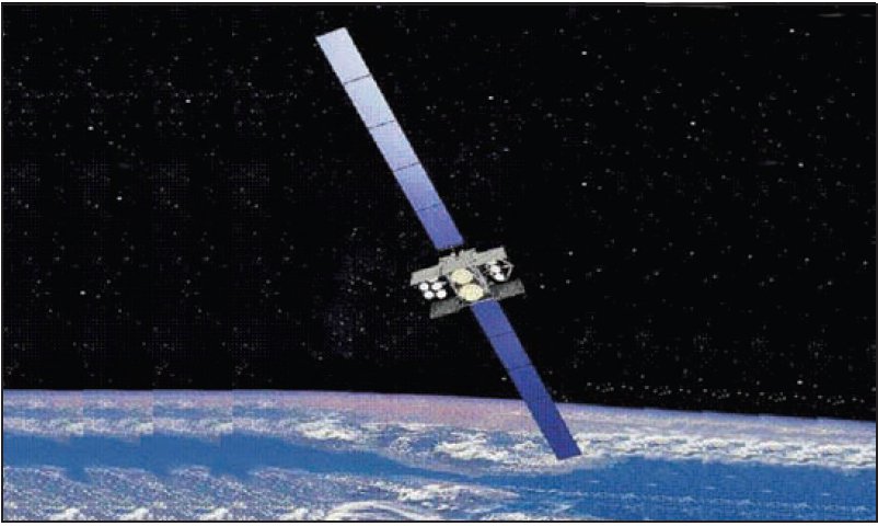
About WGS F8 (USA 272)
WGS F8, cataloged under the designation USA-272 and assigned NORAD ID 41879, is a United States military communications satellite operating in geostationary orbit. Launched in December 2016, it forms part of the Wideband Global SATCOM (WGS) constellation, a program designed to provide high-capacity broadband communications for American and allied military forces around the world. The satellite is registered under the international designator 2016-075A and remains operational in orbit as of the time of writing.
Mission and Purpose
The Wideband Global SATCOM program represents the United States military's principal architecture for satellite-based wideband communications, providing voice, video, and data relay capabilities to warfighters, command elements, and allied partners across multiple frequency bands. WGS satellites serve as high-throughput relay nodes linking ground forces, aircraft, naval vessels, and command infrastructure, enabling real-time situational awareness and coordination across geographically dispersed theaters of operation.
WGS F8 is the eighth spacecraft in the WGS series to reach its intended geostationary station, continuing the progressive expansion of the constellation's global coverage. The program is operated by the United States Air Force, which procured WGS F8 as a government asset, and the satellite has been positioned to support coverage over the Pacific region. While the specific details of its communications payload and exact channel configurations are not publicly recorded in the satellite catalog, WGS satellites as a class are known to operate in both X-band and Ka-band frequencies, providing significant throughput advantages over their predecessors in the Defense Satellite Communications System.
The broader WGS constellation was designed to serve not only American military branches — including the Army, Navy, Air Force, Marine Corps, and Coast Guard — but also international partners through established government-to-government agreements. Nations such as Australia, Canada, Denmark, Luxembourg, the Netherlands, and New Zealand have contributed funding to the program in exchange for access to constellation capacity. This cooperative model makes WGS F8 part of a genuinely multinational communications infrastructure, even as it remains a United States government asset.
The mission status of WGS F8 is not publicly confirmed in available catalog data, and no decay or reentry date has been recorded, indicating the satellite is still present in orbit and has not been officially retired to a graveyard orbit or undergone controlled disposal as of the time of this writing.
Orbit and Tracking
WGS F8 occupies a geostationary orbit with an apogee of 35,795 km and a perigee of 35,793 km, making it an exceptionally circular orbit with a difference of only two kilometers between its highest and lowest points. This near-perfect circularity is characteristic of well-maintained geostationary spacecraft, where station-keeping maneuvers are performed regularly to counteract the gravitational perturbations from the Moon, the Sun, and the slight oblateness of the Earth.
The satellite's orbital inclination is recorded at 0.0°, confirming that it lies precisely — or very nearly so — within the plane of the Earth's equator. This equatorial alignment is essential for geostationary operation: satellites at non-zero inclinations appear to trace a figure-eight pattern, known as an analemma, across the sky as seen from the ground, which complicates the use of fixed directional antennas on terminals. An inclination of 0.0° means ground-based terminals can point at a fixed position in the sky without tracking mechanisms, a critical operational advantage for military and commercial communications infrastructure alike.
The orbital period of WGS F8 is 1,436.1 minutes — approximately 23 hours and 56 minutes. This figure closely matches the Earth's sidereal rotation period, which is the physical basis of the geostationary condition: a satellite completing one orbit in exactly the same time the Earth completes one rotation beneath it will remain stationary over a fixed point on the equator. The slight difference between the sidereal day and the 24-hour solar day accounts for the precise value observed.
WGS F8 is stationed in the vicinity of 135° West and 149° East longitude — positions that correspond to geostationary slots offering broad coverage of the Pacific Ocean region, including the western United States, Hawaii, Australia, and large portions of Asia. This positioning complements other members of the WGS constellation, which are distributed around the geostationary belt to provide continuous global coverage at most militarily relevant latitudes.
The satellite carries NORAD catalog ID 41879 and can be tracked through standard two-line element (TLE) sets published by the 18th Space Control Squadron and made available through tracking databases including LowEarth. Because geostationary satellites move very slowly relative to Earth-based observers — effectively hovering over a fixed geographic point — their orbital elements change gradually over time, primarily as a result of station-keeping maneuvers.
Design and Operator
WGS F8 was launched on December 6, 2016, carried into orbit by a Delta IV launch vehicle from Cape Canaveral. The Delta IV, developed by United Launch Alliance, was at that time one of the United States' primary heavy-lift vehicles for placing large national security payloads into geostationary transfer orbit. The manufacturer of the WGS F8 spacecraft itself is not publicly confirmed in available catalog records.
WGS satellites as a class are built to Boeing's BSS-702 bus, a widely used commercial satellite platform adapted for military use. The 702 bus is known for its high power output, use of xenon ion propulsion for station-keeping, and capacity to support large communications payloads. However, specific design details for WGS F8 — including its mass, power rating, and payload configuration — are not officially disclosed in public catalogs, and no mass figure is recorded for this object. Readers should treat any figures cited elsewhere with caution unless they come from official government or manufacturer releases.
The satellite is operated by the United States government, with the United States Air Force serving as the primary program authority. Since the establishment of the United States Space Force in December 2019, operational responsibility for on-orbit military satellite constellations including WGS has transitioned in part to the new service branch, though the Air Force retains acquisition and program management roles. The satellite itself predates the Space Force's establishment, having been launched under Air Force auspices.
Significance and Current Status
WGS F8 represents a significant step in the long-running effort to modernize and expand American military satellite communications capacity. The WGS program was conceived as a replacement for the aging Defense Satellite Communications System, offering substantially greater bandwidth, flexible frequency routing, and improved connectivity for the increasingly data-intensive demands of modern joint operations. Each WGS satellite provides many times the bandwidth of its DSCS predecessors, and the constellation as a whole has substantially increased the aggregate communications throughput available to U.S. and allied forces.
As the eighth member of the WGS constellation, WGS F8 continued filling gaps in the global coverage architecture, extending the network's reach and providing redundancy across key orbital slots. Its placement over the Pacific region is strategically significant given the importance of that theater to American military planning and the communications requirements of forces operating across the Indo-Pacific area of responsibility.
No reentry or decay date has been recorded for WGS F8, and the satellite is tracked as still in orbit under its assigned NORAD identifier. Geostationary communications satellites are typically designed for operational lifespans of 15 years or more, supported by onboard propellant budgets sufficient for regular station-keeping over that period. At the conclusion of their operational lives, such satellites are typically moved to a graveyard orbit several hundred kilometers above the geostationary belt to vacate their orbital slots for successor spacecraft. No public information indicates that WGS F8 has reached or is approaching end-of-life operations, though mission status is not confirmed in the publicly available catalog record.
The WGS program continues to evolve, with later variants and follow-on architectures under development to sustain and improve military wideband communications capabilities into future decades. WGS F8's contribution to that architecture, however, remains a fixed point in the constellation — an asset positioned in the geostationary belt whose steady presence supports the communications fabric upon which modern joint and coalition military operations depend.
Observability
WGS F8 resides in geostationary orbit at an altitude of approximately 35,793–35,795 km, placing it far beyond the altitude ranges in which satellites are commonly observed with the naked eye during twilight passes. At that distance, the satellite subtends an extremely small angle and reflects comparatively little sunlight to an Earth-based observer. It will not produce the kind of bright, fast-moving passes associated with low-Earth-orbit objects such as the International Space Station or many imaging satellites.
From the ground, a geostationary satellite at the appropriate longitude will appear as a fixed, extremely faint point relative to the star background — effectively stationary in the sky rather than moving across it. Detection typically requires at minimum a moderate-aperture telescope and some patience. Astrophotographers sometimes capture geostationary satellites as stationary dots while stars trail in long-exposure images, which provides an intuitive illustration of the orbital geometry. For practical satellite-spotting purposes, WGS F8 is not a naked-eye target under any normal observing conditions.
Altitude history
Apogee and perigee for WGS F8 (USA 272) across 148 days of archived orbital elements (150 element sets, one per day).
Derived from our own archive of CelesTrak orbital elements, sampled every 3 hours. Short windows show drag and station-keeping; they are not a reentry prediction.
Related satellites
Sources & further reading
Embed this satellite on your site
Free for editorial use. Attribution back to LowEarth is required.
<iframe src="https://lowearth.app/embed/41879" width="640" height="400" frameborder="0" allow="fullscreen"></iframe>