WGS F4 (USA 233)
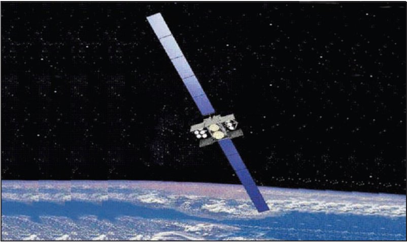
About WGS F4 (USA 233)
WGS F4, cataloged by NORAD as object 38070 and internationally designated 2012-003A, is a United States military communications satellite operating in geostationary orbit. Launched on January 19, 2012, it is the fourth spacecraft to fly under the Wideband Global SATCOM (WGS) program and holds the distinction of being the first member of the program's Block II series to reach orbit. The satellite is operated by the United States Air Force and remains active in geostationary orbit, stationed at 88.5° East longitude.
Mission and purpose
The Wideband Global SATCOM program exists to provide the United States military with high-capacity, wideband satellite communications in support of a wide range of defense activities. WGS satellites serve as the backbone of the Department of Defense's wideband communications architecture, enabling voice, video, and data relay for warfighters, command authorities, and intelligence platforms operating across the globe. The system is designed to dramatically increase the throughput available to joint and coalition military forces compared to earlier generations of defense communications satellites.
As the fourth satellite in the WGS constellation, WGS F4—also known by its military designation USA-233—expanded the network's capacity and geographic reach when it entered service in 2012. Its position at 88.5° East places it over the Indian Ocean region, a longitude that provides coverage across South Asia, the Middle East, East Africa, and portions of the Pacific, areas of sustained strategic and operational interest for the United States and its allies. The WGS constellation as a whole is designed to support not only American forces but also partner nations participating in cooperative access arrangements, allowing allied militaries to utilize the system's capacity under formal agreements.
WGS F4's mission type and current operational status are not publicly detailed in available satellite catalogs, which is consistent with the general handling of military communications assets. The United States Air Force has not released specific technical details about the satellite's transponder configurations, frequency bands, or service utilization in open sources, and accordingly those specifics are not represented here.
Orbit and tracking
WGS F4 occupies a near-perfect geostationary orbit, as reflected in its tracked orbital parameters. Its apogee stands at 35,798 km and its perigee at 35,794 km, a difference of only four kilometers that indicates an exceptionally circular orbit. The inclination is recorded at 0.0°, confirming that the satellite's orbital plane lies essentially coincident with Earth's equatorial plane — the defining characteristic of a true geostationary orbit. Its orbital period is 1,436.2 minutes, or just under 24 hours, which allows it to remain effectively stationary relative to a fixed point on Earth's surface.
The near-zero eccentricity and equatorial inclination of WGS F4's orbit are not accidental. Geostationary orbit is the standard choice for communications satellites intended to serve fixed or semi-fixed ground terminals, because a stationary apparent position eliminates the need for ground antennas to continuously track the spacecraft. Military communications networks in particular benefit from this predictability, since ground terminals — whether fixed installations, shipborne systems, or deployed tactical nodes — can be pointed once and maintain a persistent link without mechanical reorientation.
Maintaining such a precise geostationary slot requires periodic station-keeping maneuvers. Perturbations from the Moon's and Sun's gravitational influence, as well as subtle variations in Earth's gravitational field, tend to nudge a geostationary satellite away from its assigned longitude and introduce small inclination errors over time. Station-keeping thruster firings counteract these drifts and are a routine part of geostationary satellite operations throughout the spacecraft's service life.
Because WGS F4 sits at geostationary altitude — approximately 35,800 km above the equator — it is far too faint to be observed with the naked eye under any conditions. It can be detected with moderate to large amateur telescopes under dark skies if the observer knows precisely where to look, but it presents as an extremely slow-moving or effectively stationary point of light indistinguishable from background stars without careful time-lapse observation. Dedicated satellite tracking tools, including those on this site, can compute its precise position in the sky for any ground location at any given time based on its cataloged orbital elements.
Design and operator
WGS F4 was built as part of the WGS Block II series, which introduced improvements over the original Block I satellites that preceded it. The specific manufacturer of WGS F4 is not recorded in the publicly available satellite catalog, and its launch mass is similarly not listed in open sources. The Block II designation generally refers to an upgraded variant within the WGS program, though the precise nature of those enhancements has not been fully disclosed in public documentation.
The satellite was launched on January 19, 2012, and was assigned the international designator 2012-003A, indicating it was the primary payload of the third launch of 2012. The launch vehicle and launch site used for this mission are part of the broader public record of the WGS program, and the mission placed the satellite directly into its intended geostationary slot without difficulty, as the satellite has remained in a stable geostationary orbit since that date.
Operational responsibility for the WGS constellation rests with the United States Air Force, which manages the satellites as part of the broader Defense Satellite Communications architecture. Day-to-day command and control of WGS satellites is handled by specialized Air Force units with training in military satellite communications operations. The constellation is managed as an integrated system rather than as individual assets, with capacity allocated across the network according to theater demands and mission priorities.
Significance and legacy
WGS F4's primary historical significance lies in its status as the first Block II spacecraft within the WGS program to reach orbit. In satellite programs, the transition from one block to the next typically marks a meaningful evolution in capability, reliability, or design, even when the specifics of those changes are not publicly disclosed. As the trailblazer for the Block II series, WGS F4 validated the upgraded design and paved the way for subsequent Block II and later spacecraft in the constellation.
The WGS program itself represents a significant generational leap in United States military communications satellite capability. Earlier defense communications satellites were limited in their data throughput by the technology of their era. The WGS constellation was conceived and built to address the dramatically increased bandwidth demands of modern networked warfare, where high-definition video feeds from unmanned aerial vehicles, real-time command links, and large-volume intelligence data flows all compete for satellite relay capacity. WGS satellites are among the highest-capacity military communications satellites ever constructed, and the addition of each successive spacecraft to the constellation has meaningfully expanded the aggregate capacity available to military users.
WGS F4's position at 88.5° East contributes to the constellation's global coverage architecture. By occupying that longitude, it ensures that users in regions of high operational tempo — including the Indo-Pacific and Central and South Asian theaters — have access to wideband communications relay without depending solely on ground-based infrastructure or other satellite assets. In contested or austere environments, the availability of reliable satellite communications can be decisive, and the WGS constellation as a whole, with WGS F4 as one of its constituent members, is a foundational element of American and allied warfighting capability.
The satellite remains in orbit as of the most recent catalog update, with no decay or reentry date assigned. Geostationary satellites of this type are typically designed for service lives measured in decades, and at the conclusion of their operational service, they are ordinarily moved to a higher "graveyard" orbit above the geostationary belt to clear their slot for successor spacecraft. Whether WGS F4 has reached the end of its active operational life or continues in primary service is not reflected in publicly available catalog data; its continued presence in geostationary orbit is confirmed, but its operational status remains undisclosed.
As the WGS constellation has grown with subsequent launches, WGS F4 has become one part of a larger, increasingly capable network. Its role as the first Block II satellite, however, gives it a fixed and notable place in the developmental history of American military space communications infrastructure. For researchers, satellite trackers, and observers interested in the evolution of military space systems, WGS F4 represents a concrete milestone in that ongoing progression.
Altitude history
Apogee and perigee for WGS F4 (USA 233) across 148 days of archived orbital elements (150 element sets, one per day).
Derived from our own archive of CelesTrak orbital elements, sampled every 3 hours. Short windows show drag and station-keeping; they are not a reentry prediction.
Related satellites
Sources & further reading
Embed this satellite on your site
Free for editorial use. Attribution back to LowEarth is required.
<iframe src="https://lowearth.app/embed/38070" width="640" height="400" frameborder="0" allow="fullscreen"></iframe>